Saturday I went up to the end of Spruceton and did the last 3 peaks I needed in that area... South West Hunter, Hunter, and Rusk. Planning had this at 10.8 miles, but GPS clocked in at 11.9 which may be true because of a couple of the side trails I did, plus the route I planned had a couple short cuts that were not there in reality.
The hike up to SW Hunter was a nice wooded trail with the normal rocks and such on the ups. When I got to the ridge there were a couple mud pits, but they were easy to get through. By the time I got to the turn off to the herd path, 3 others were there and about to head up. I don't think they were that experienced of a hikers though. 2 of them had passed the herd path because they were fast hikers that were obviously not paying attention. The third was someone that changed his plans after talking to me on the way up. So the four of us go down the herd path at a good speed (it was flat). I was in the back, and as I start to step over a brush pile I see the trail actually goes left. I yell out that the trail turned here, but the 2 in front just kept going on what looked like a trail but wasn't. So the 2 of us in back went up the proper herd path and I explained to him how the canisters and notebooks work.
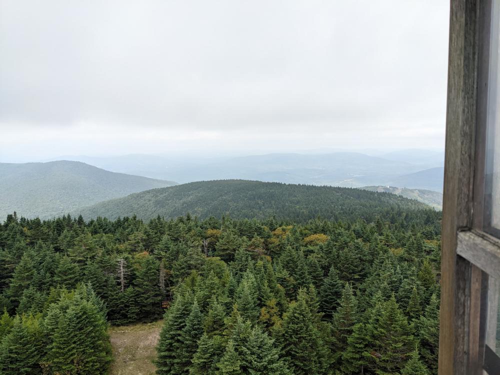
From there, it was back to the marked trails and up to Hunter. I took a quick stop at the lean-to on the way up and topped off my water and evacuated the bowels at the privy. The marked trail from here on was good. Once you get close to the the ridge, it transformed into a lovely moss covered forest that was just beautiful to walk through. Then I got to the fire tower. It was busy, but it was open. I talked a little with the caretakers for the weekend, and took in the views, then off I went. From here on, the trail down was a forest road in relatively good condition.
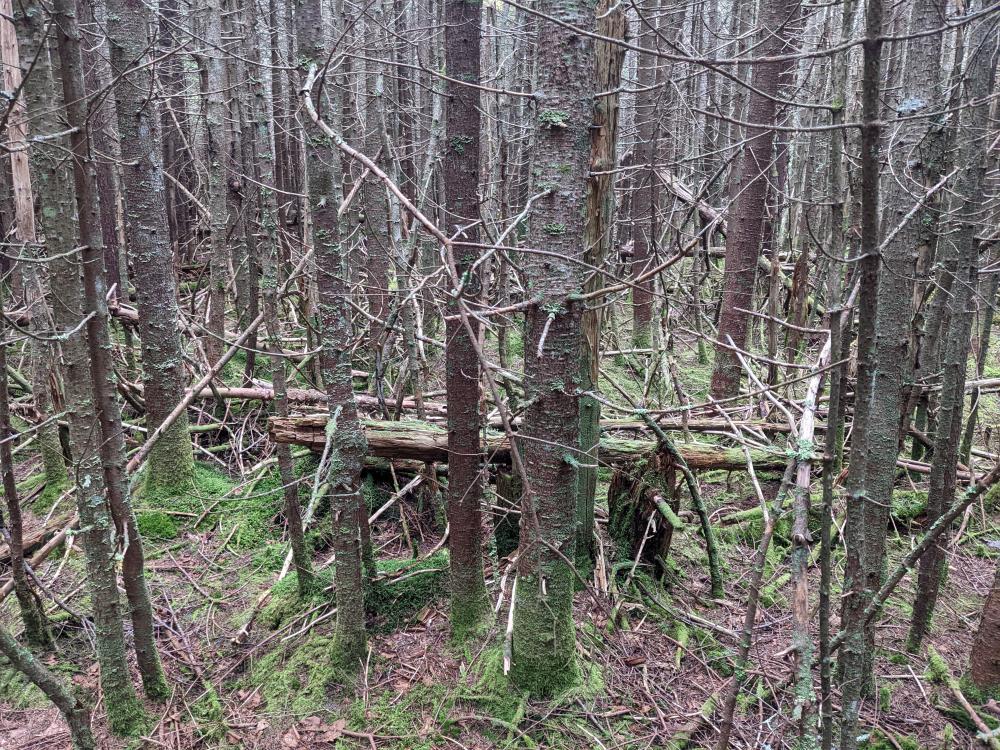
At the "big turn left", I left the marked trail to go up Rusk. Well, it took a minute to find the trail. While this is listed as a common way up Rusk in the guide book, it's obviously this is not the way most go up. The herd path follows the ridge over East Rusk then to Rusk. Well, I'd say 85% of it was obvious enough that a skilled hiker could recognize the trail The other 15%, mostly on the top of East Rusk and just past it was just not obvious to me. Backcountry navigation skills are truly required to follow this herd path. I eventually got to the peak though, signed the book and found I was the 2nd person that day (1 person started the herd path the same time as me but went much quicker). This was like 3 in the afternoon, so it seems like this peak is not one people do unless they really need to do it. Then the trail down was obviously the one that most people do. This was clear as day, even though it did go down a 45+ degree slope of loose rocks at one point. I'm glad I went down it instead of up it. I finally got out of the woods at 7 hours for nearly 12 miles.
This completes my Catskill Fire Tower Challenge and are peaks # 15, 16, and 17 for the Catskill 35.... meaning I'm over half way done (33 peaks) if you don't include the 4 that must be repeated in the winter.


Add new comment