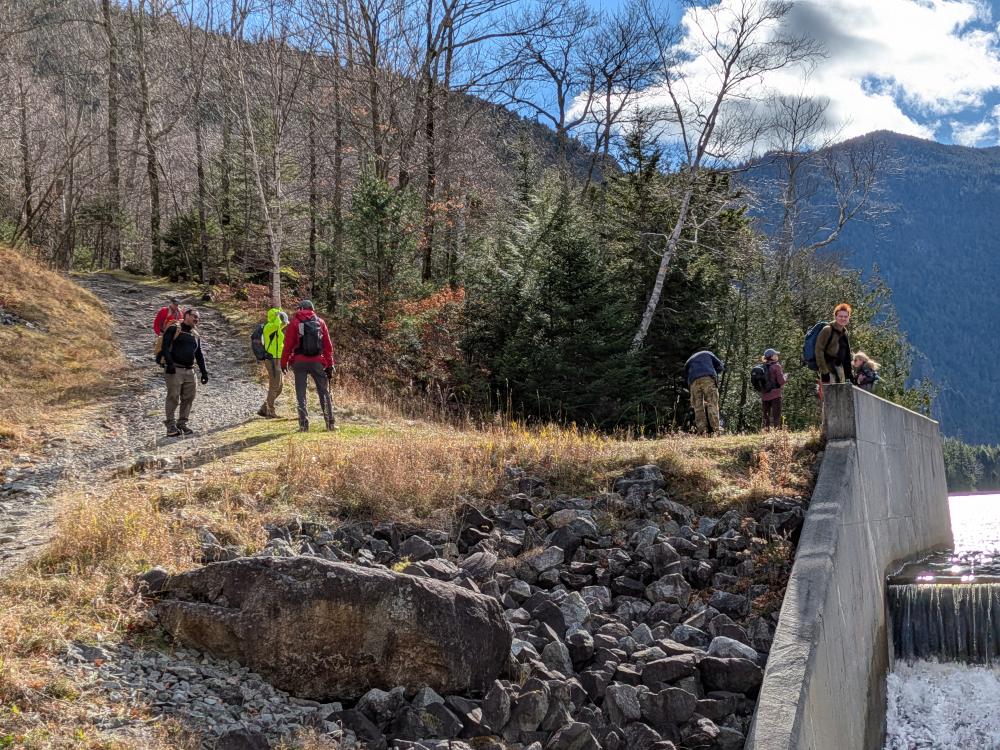
Yesterday I lead 11 other people on a hike for ADK. It was what I consider to be a relatively easy hike for the area, but it is over 10 miles and over 2000 feet of elevation (most of it very gradual). As a result, it had to be rated an A hike, but I really wanted to call it a B/B+. Doesn't matter though, I got 11 others interested in it, and we set off shortly after 8 from the AMR lot. I was surprised at how full the lot was, and it was even fuller when we got back at the end of the day. Lots of people out there hiking!
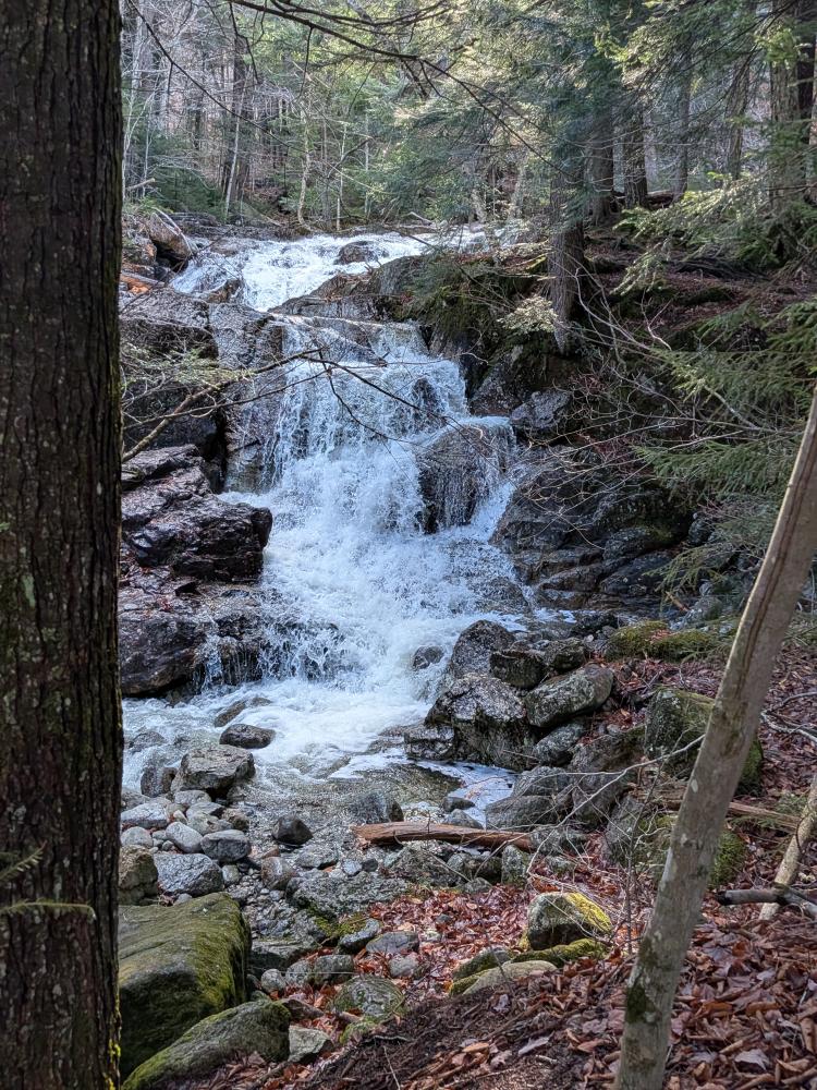
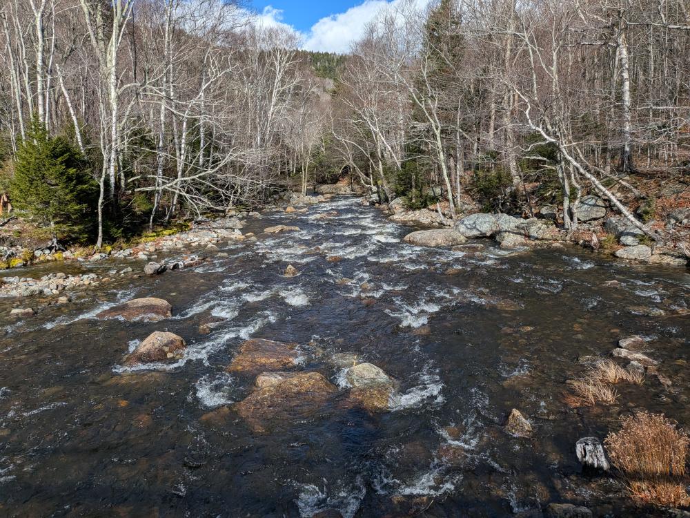
The hike in to Gill Brook was typical. We pushed a little faster than we should have, with one person falling back. The hike up Gill Brook though was slow so everyone could take many pictures. It was flowing strong, thanks to the many recent rains we've had. As a result, the falls and cascades were absolutely beautiful. We then reached state lands and went over to the Fish Hawk trail. Not that bad of a trail, but there was a bit of standing water and mud along the way, nothing horrible by ADK standards, but something that had to be picked through/around with care. The views from the cliff didn't disappoint. None of us went down to the lower viewpoint, but we got a taste of what we would see.
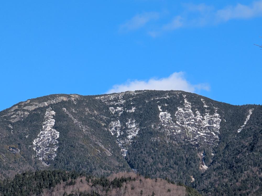
Then we headed over to Indian Head. Again, a bit of mud, but nothing unusual. The climb up at the very end of the fish hawk trail was steep, but only one rock that was difficult to get up. Much better than the scramble you have to do on the way in on the Indian head trail. Still, it was steep and we took our time. Then, the ledges. They were beautiful as usual. High clouds allowed us to see everything, wind caused us all to put on another layer, and we seeked a bit of shelter towards the back of the lower ledges to eat, well, for the group to eat, I was my typical self and never brought out the trail mix with the muffin and egg sandwiches I had on the way in satisfied me.
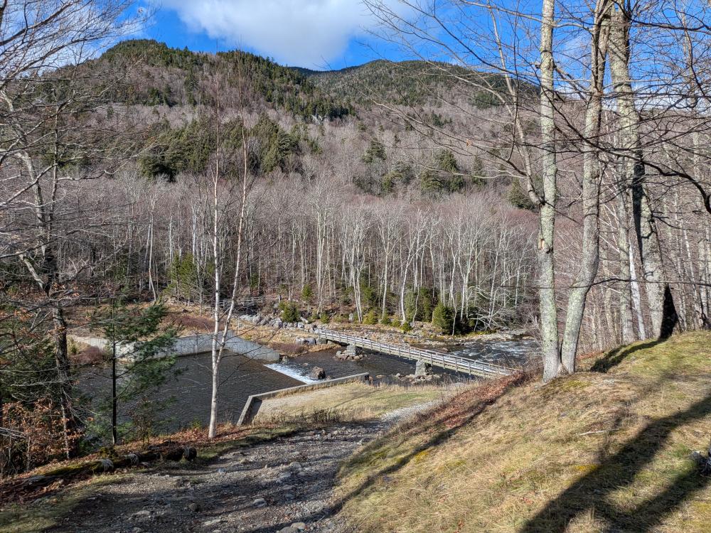
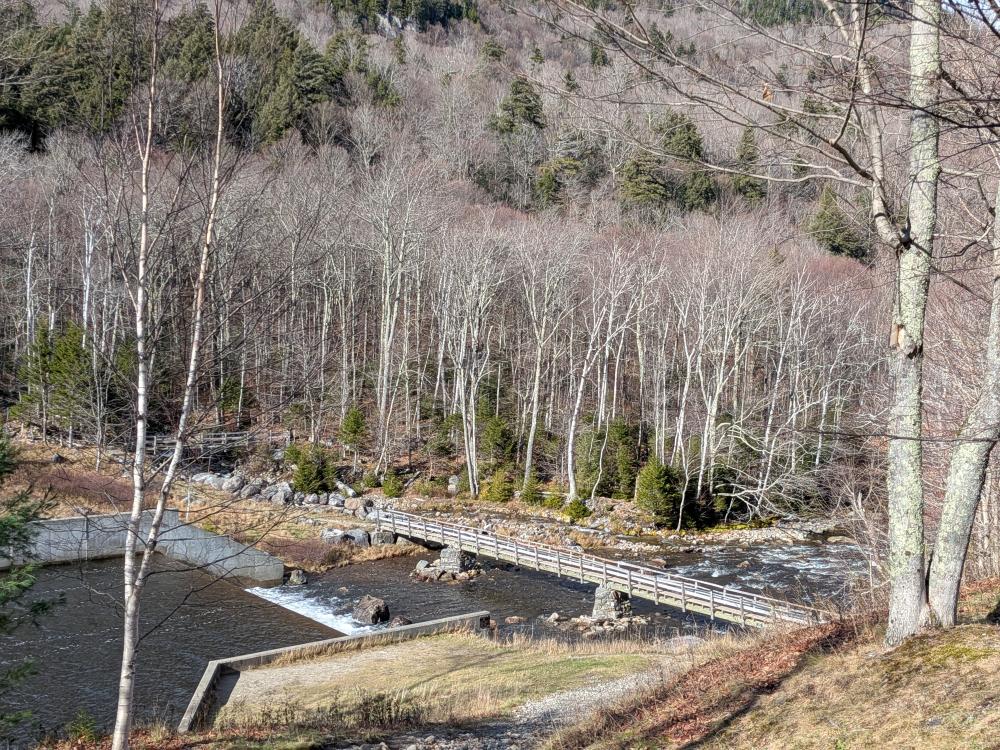
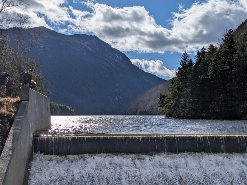
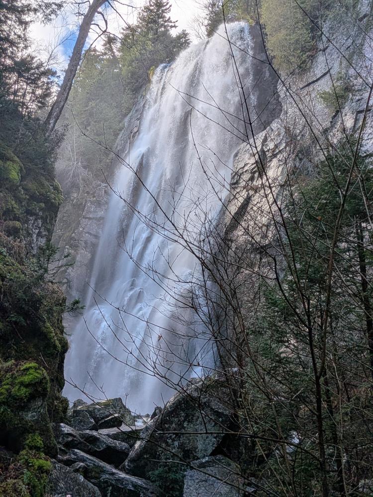
After a bit of relaxing on the ledges, it was back up to the top and then down the short way to the road. I offered that leaving packs at that point was ok, warning we were going to be going down a steep road that we'll have to come back up. Nobody took me up on that. So, it was off to the dam, and the great views from there, and then to the junction of the Weld and Rainbow falls trail. Most of us went up the short climb on Weld to the "Don't be a dropout" sign and overlook of the falls. Then down we went and in to the bottom of Rainbow Falls, which always impresses. If I am in that part of AMR property, I never skip seeing the falls if I have enough daylight. They are impressive.
We decided that we've had a good day, so road all the way back to the start. Next time I'll do a different hike where we come in and explore the west river side of the property, hitting Beaver Meadows Falls in the process. But it was a good day overall.
In the end, GPS tracked 11.13 miles over 6.22 hours and 2400 feet of elevation. That brings me to 307 miles over 205 hours and 14.9 miles of elevation for the year. I passed the 300 mark!


Add new comment