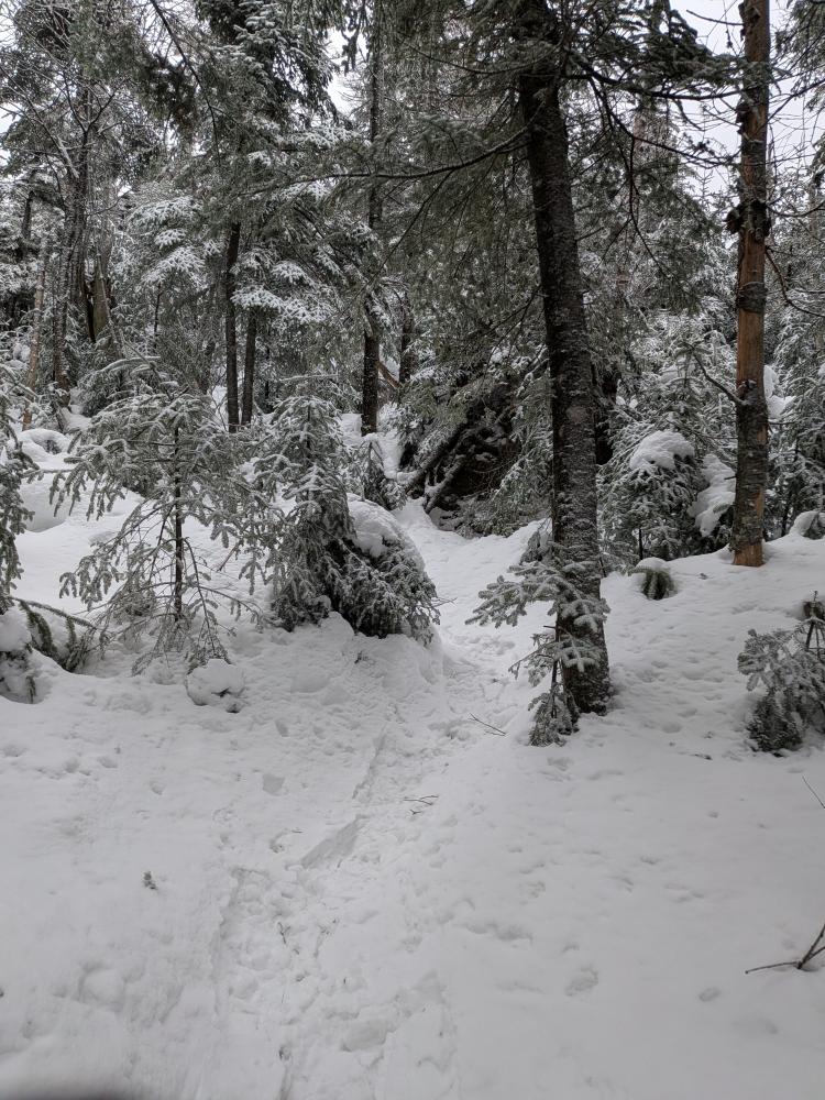
It was a long day. We started in spikes as the trail looked thin at the start and expected to run into more open spaces. It was a bad choice as it was soft enough that we were making divots in the trail and not really gaining much speed wise. About 1/2 way down the Calkins Brook Truck Trail we switched to snowshoes. After that it wasn't bad.
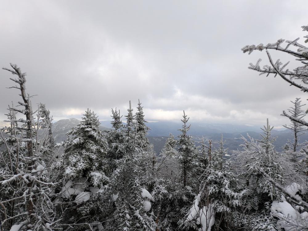
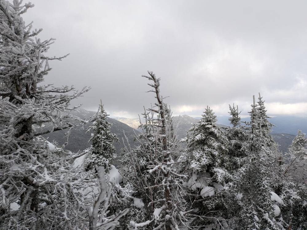
The herd path up Calkins brook is just lovely, and relatively speaking, easier than the other approach. By about 3000 feet I noticed the snow on the trail changed. Below that it was mostly a crusty snow that wasn't sticky, but still soft. Above 3000 it was turning more into powdery snow with a bit of crust in it. We also started seeing the trail more blown in as we got up, to the point that it was very difficult to find the previous trail in some spots once you get close to the ridge.
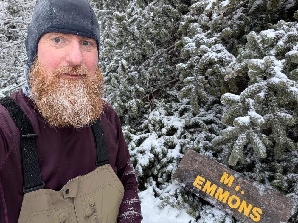
We went over Donaldson first, didn't see any marker (I know it had one in 2020, and I misremembered that it was a yellow disk, it was a painted sign) Off then to Emmons which is where we created a couple mistakes finding the trail, we did find it eventually, and then up to Emmons where the couple that came up just after us found the sign and we left it on the branches of the spruce up there. Then it was back to the trail junction for Seward.
My group of 3 and the couple talked it over, it was only a bit after 2, and we decided with 5 of us, we can get Seward and hope that breaking trail down to Blueberry wouldn't be bad. The trail to Seward was much like the trail to Emmons. We made a few wrong turns, the worst being just before you take that long steep straight climb to the top . We didn't see a trail, and didn't believe we needed to follow the wall of rock. We were wrong. This is the section without snow where you have the erratics you climb over/through. I know this because I broke through at one point and there is a bit of a hole on that final climb. When we got close to the top, we ran into someone coming the other way solo. Excellent! The trail out was broken(ish.... 1 person doesn't really break a trail) At that point, the hike out was uneventful, but a late exit. We didn't find the sign on Seward, but at that point, we really didn't want to spend time looking for it, sunset was about 15 min after we summited.
I didn't come out without injuries though. The snow is quite deep and we were in the trees a lot of the day. I took a few to the face and they actually cut me, the worst being my nose which kept bleeding a slow dribble for the last 4 hours of the hike. They were small though, and not that obvious after showering. I picked up a lot of new bruises and scratches on my arms and chest, but that's not really unusual for winter hiking. There were 2 things that happened though that raise to a level of concern. First was my fingers froze at one point. We were slow breaking trail uphill, and my gloves were wet. The damage isn't bad, but I did get frostnip/frostbite. Hopefully the numbness in my fingertips goes away in a few days. The other was my knee. I tweaked it somewhere on the ridge, and by the time we were heading down, it was starting to hurt significantly more. Feels like tendinitis or similar, and NSAIDs seem to be working. No swelling or deformity compared to the other knee. I'm getting a sturdier brace to hike with and resting the knee, hoping it feels better by the end of the week.... it currently is feeling better than the hike out, so I have hope.
The other thing is it was a very wet day. I got home and out of my shell pants/bib, and I was soaked through on all layers. I know at the start, it was 34 at the car, and my head band to keep the ears warm was more like a sweat band. I took it off and was able to squeeze water out of it. This was the first time I used the bibs, and I do like them, but I need to figure out what layering I truly need under them. In addition, when I showered when I got home, I had spruce needles everywhere on my body. What a mess! But it wasn't just clothing that was wet, everything was. When I pulled the pack out of the car, I just unpacked it and let everything dry out.
In the end, it was a long day. GPS says 16.9 miles and 4600 feet of elevation over 13.75 hours. That's about 1.2 miles and 600 feet more than the mapped route. 3 more down, and 15 left for my winter round of 46... if my knee cooperates, it's doable by the end of this season. fingers crossed. Still early in the year but already 31 miles and 22.5 hours with 1.4 miles of elevation so far this year.


Add new comment