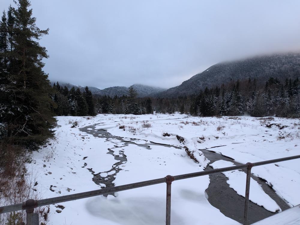
I started the day out with high hopes of getting both Cliff and Redfield checked off my list on the last day of winter hiking. We started off from ADK Loj and it felt weird to be hiking in just microspikes to start the hike. The hike in to Marcy Dam was the typical quick jaunt. As we crossed the bridge to the south side, the snow made a subtle but noticeable change from the firm ice to a more slippery slightly deeper and softer snow. That is when I switched over to snowshoes and they didn't come off until I hit the car at the end of the day.
This was the third time this winter that I've hiked in to Lake Arnold, and as it has been each time before, the constant uphill just drags on. The good thing about it though is that all the rocks that make it difficult in the summer were still long buried. Shortly after reaching the crossover trail you come to the first of many stream crossings. It was one of these crossings below Lake Arnold that there was a report that it was not crossable 3 days earlier. The water was low, and we only had an issue climbing up the banks of snow on either side of it.
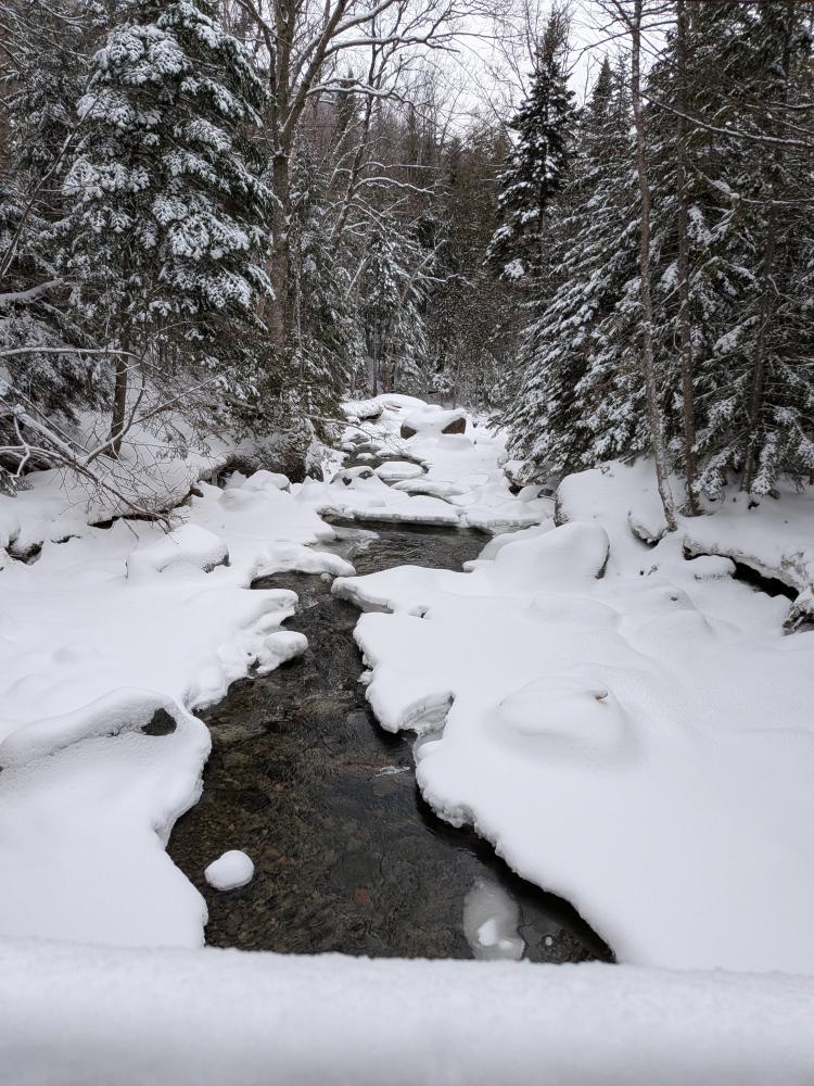
From Lake Arnold on, we were breaking trail. I took the lead to go up to the top of the pass, and a few minutes after I let someone take over. At another stream crossing, I ended up going around the log the lead was trying to cross and took the lead again until we got to the next big crossing, the Opalescent River. The last time I was on this section of trail, it was snowing and grey out, so I didn't get a good view of the damage from the slide on that side of Colden last summer. This hike, I was able to see it, and wow, mother nature is impressive. Then going through the floating logs, we took what were the logs as everything was frozen and under feet of snow.
The Opalescent River crossing was surprisingly good. Steep banks on either side, but it really was not high water, and the ice with the rocks in the river made it crossable with some care. One person dunked a foot in, but nothing too bad. After the river, you could tell that it was flooded for a bit as the trail was worn down to a channel that was nearly down to dirt, and at points only one snowshoe wide. This lasted a few hundred feet then we climbed out of it and shortly after got to the Feldspar Brook. This again was low and not bad to cross. Once again, 1 person did get a foot dunked in, but nothing bad, and no wet feet.
The Marcy trail down to Uphill Leanto was partly broken out by what looked like someone going up towards Marcy, but not broken out as in that day, probably was on Friday. Then we came to the Uphill Brook. This was the last water crossing of concern, and we knew of 2 people that turned around there 2 days prior because it was too high. The crossing was just fine, a couple people did break through a little bit, but no issues with getting wet.
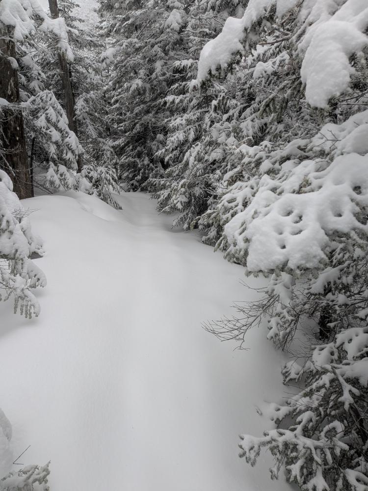
We now left the marked trail and tried to find our way up Cliff. For the most part, the trail was pretty obvious. For a trail that was broken out by at least 8 people 2 weeks earlier, it was kind of surprising how little of it was visible. We found our way up the 3 cliffs. The first one had a small ice bubble, but there were trees you could grab to get up it. The second and third cliffs were not too bad, just steep and a bit of ice under the snow. Snowshoes and my whippet were more than enough. At the top, it was a game of "Where's the trail?" We were on probably 4 feet of snow, in many cases walking over buried trees, and the traditional herd path was visible in some spots, and then you lost it. We definitely went off it a few times, but probably no more than 100 feet. We eventually made it to the peak and celebrated.
Just before we hit the peak, I lost my In-Reach Mini 2. It got ripped off the fabric tab holding it to the clip and ended up somewhere in the snow. On the way back, I found the location based on my recorded track, and couldn't find it. There was one hole I searched, but it was above a tree, and I suspect it fell down into the tree and is buried until we are done with the melt this spring. With any luck, someone will find it and get it back to me. After emailing Garmin, I am getting a new one at a discount, but this is a one time deal. With the loss of that device, I knew that Cliff was going to be my only peak. I had planned on Redfield, and probably could have done that, but without the backup of the in-reach device, I wasn't going to risk it.
The hike off of Cliff was nearly eventful for all of us. The top cliffs are a long steep descent that you either needed to do in crampons with ice axe, walking down backwards, or butt slide. We all butt slid, and I know in my attempt to slow down/stop, I hit my hip hard, and I wrenched my shoulder grabbing another tree. The second cliff was a little better, but still did hit trees in weird ways. The last cliff was the easiest to get down, but the trail at the bottom was narrow, and you had to be careful to not slide too far. Nothing horribly dangerous as if you were going to go off an actual cliff, but still a bit scarier than expected.
Once down, it was the long slog out back to the car. The stream crossings were all similar to how we came in. The climb back up to Lake Arnold was a slog, and I knew that it was going to be. That's the one drawback of going in from Loj. It was such a pleasure to go down again though, and the hike out was uneventful.
In the end, this was about 16 miles and 3400 feet of elevation over 11 hours. It was a great day to be out with a great group of hikers that I hope to hike with again in the future. The totals so far for the year are 126 miles over 93 hours and 6.2 miles of elevation.


Add new comment